
Hurricane Erin tracker: 1st hurricane of Atlantic season weakens to Category 3

Erin is expected to re-intensify after it's weakened.
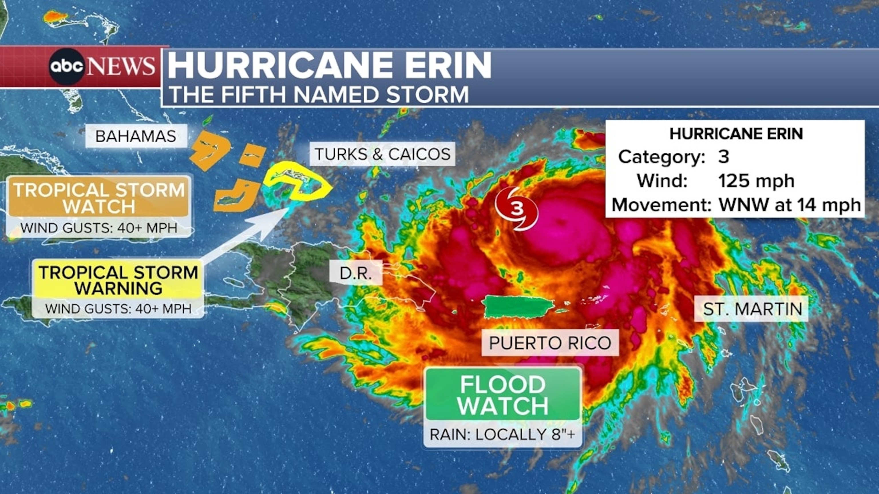
Hurricane Erin weakened to a Category 3 hurricane overnight, but still remains a formidable major hurricane.
Erin had max winds of 125 mph, the National Hurricane Center said in a 5 a.m. ET update. The next update is expected at 8 a.m. ET.
The weakening is seen as only temporary, as Erin is expected to re-intensify after completing an eyewall replacement cycle. These are natural cycles that normally weaken a hurricane by a bit, but re-intensification is normal once the cycle is completed.
As of the latest update, Erin is located about 140 miles north of San Juan, Puerto Rico, or about 330 miles east-south-east of Grand Turk Island. It's moving west-north-west at 14 mph.
Erin's outer bands continue to bring heavy rain and gusty winds to Puerto Rico and the U.S. Virgin Islands.
"Considerable" flash flood warnings are ongoing for the U.S. Virgin Islands. Between 3 to 6 inches of rain are estimated by radar to have fallen over St. John and St. Thomas, and between 2 to 4 inches have been reported for the northern sections of Puerto Rico.
Flood watches are expected to remain in effect for Puerto Rico and the U.S. Virgin islands until Monday morning. Isolated storm totals between 6 to 8 inches are still possible as the outer bands of Erin continue to pass over these areas, enough to cause quick flooding and possibly landslides and mudslides.
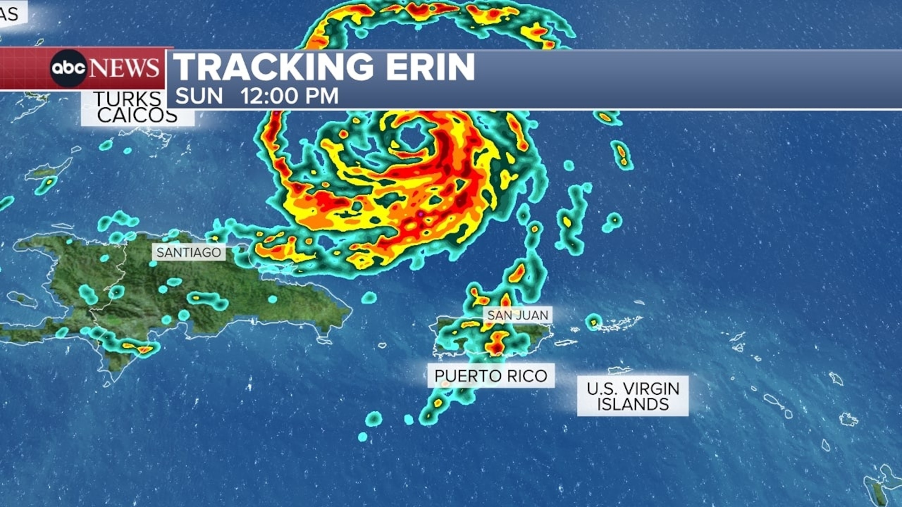
As Erin continues to move west-south-west on Sunday, the storm's outer bands will continue to bring rain and gusty winds of 40 to 50 mph for Puerto Rico and the U.S. Virgin Islands. Conditions begin to improve later this afternoon for the U.S. Virgin Islands and by tonight for Puerto Rico.
Tropical storm warnings are in effect for the Turks and Caicos Islands as Erin's outer bands will graze the islands with heavy rain and gusty winds. Tropical storm watches are also in effect for the southeast Bahamas.
Erin is still expected to slow down and begin turning to the north later today through the early work week.
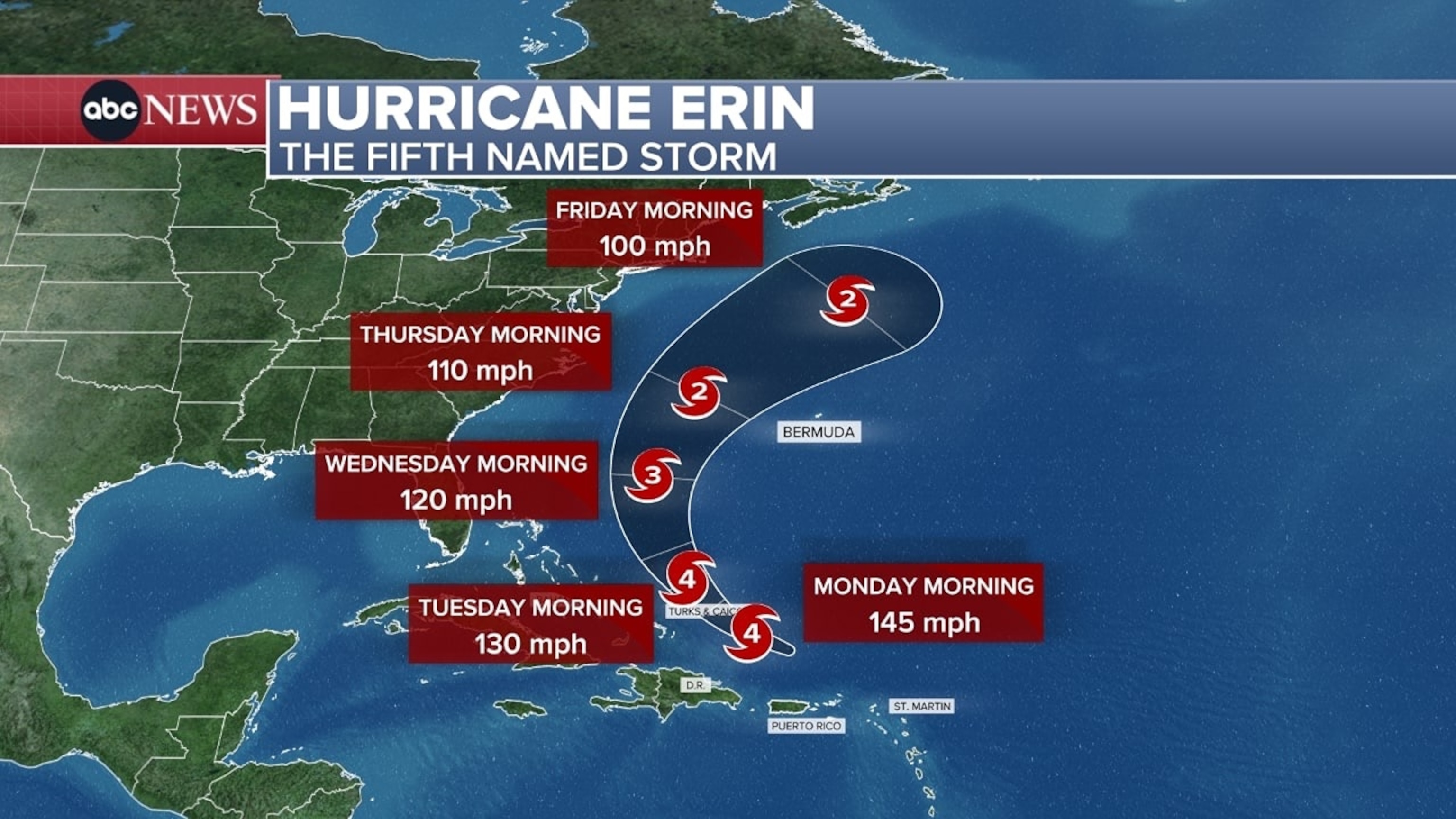
Erin's forecasted path for this week remains as of early Sunday the same as it has been for the past few days, as do the steering factors that will be at play to make it happen.
Erin will slowly turn north over the next few days thanks to the weakening Bermuda High and a cold front that will sweep through the East Coast to begin the new week.
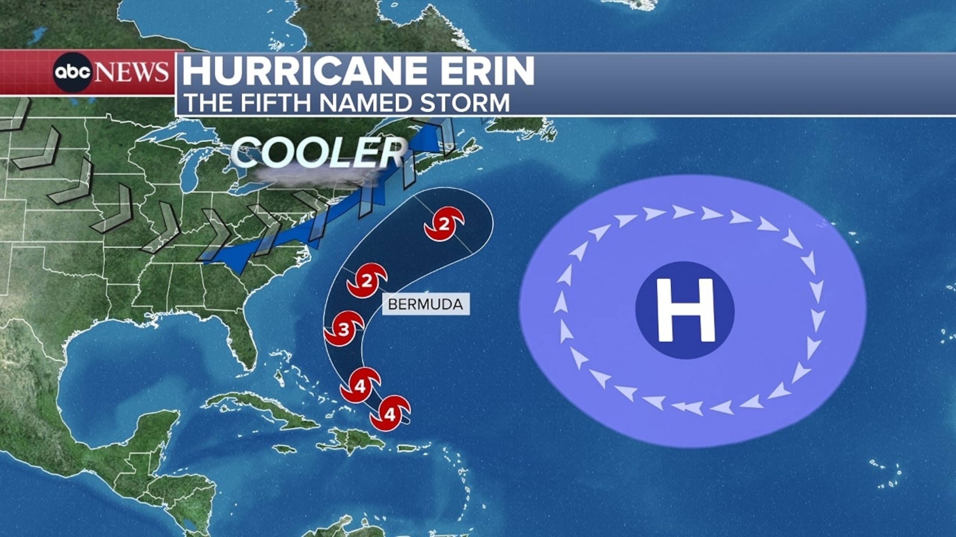
Weather models are still in good agreement on Erin steering between Bermuda and the East Coast this week, keeping any direct impacts for the U.S. Mainland at bay.
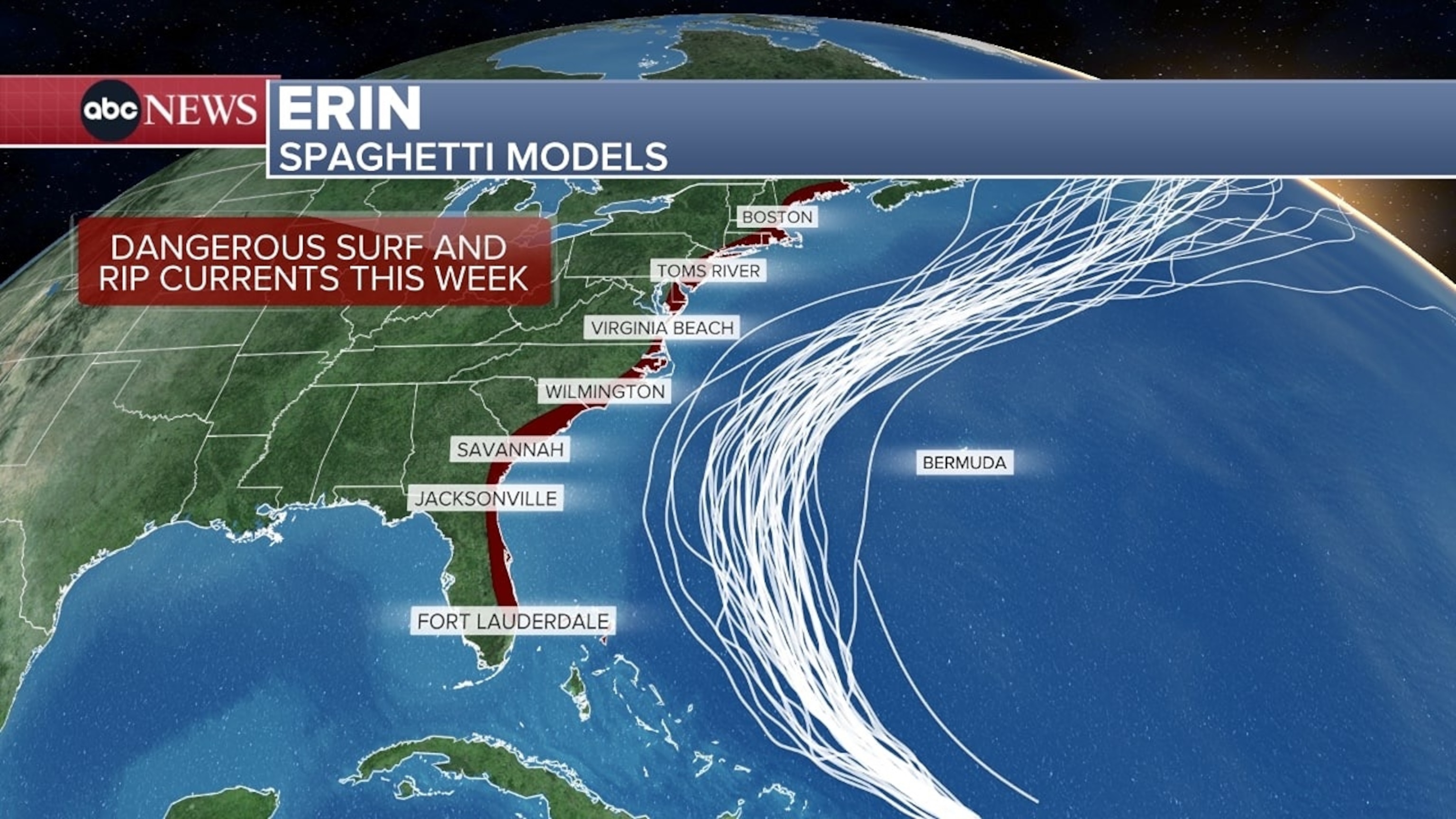
Dangerous surf and rip currents are anticipated for the U.S. eastern coastline between the Space Coast of Florida and coastal New England.
These will be driven by Erin's growing size at it treks northward this week.

The bigger the storm, the bigger the wave action that will come from it.
Very large waves will also be likely from the Carolinas to possible the Northeast by Thursday. Over 8- to 12-foot waves will be possible along the Carolina coastline, bringing not only dangerous surf but also potentially significant beach erosion that could threaten beachfront properties.
ABC News


